
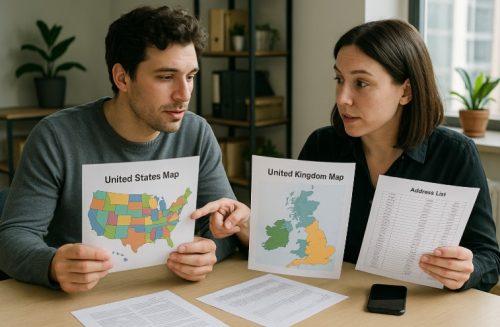
Have you ever wondered why Americans use ZIP codes while people in the UK refer to postcodes? These seemingly similar terms are actually rooted in different postal systems and serve slightly different purposes.
Although both ZIP codes and postcodes are designed to streamline mail delivery and improve address accuracy, the way they are formatted, applied, and managed varies from country to country.
In the United States, the postal system relies on numeric ZIP codes to define geographical locations. In contrast, the UK and many other nations use alphanumeric postcodes that convey even more specific regional information.
Understanding these differences isn’t just useful for travellers or expats it’s essential for businesses, logistics services, and marketers operating across borders.
In this article, we’ll explore the real difference between ZIP codes and postcodes, how they’re used in their respective countries, and why they matter far beyond just delivering mail.
What is a ZIP Code and How is It Used in the US?

A ZIP code, short for “Zone Improvement Plan” code, is a system used by the United States Postal Service (USPS) to streamline the sorting and delivery of mail. Introduced in 1963, ZIP codes help segment the country into specific regions for more efficient postal operations.
The ZIP code system is purely numeric and typically consists of five digits. In 1983, the USPS introduced the ZIP+4 format, which adds a hyphen and four extra digits to provide even more accuracy.
The breakdown of a ZIP code is as follows:
- The first digit represents a broad geographic area in the US.
- The next two digits signify a regional centre.
- The last two digits indicate a local post office or delivery area.
For example, ZIP code 90210 refers to Beverly Hills, California. If we add the +4 extension 90210-1234 it narrows the location to a few city blocks or a specific building.
ZIP codes are essential for:
- Speeding up mail delivery
- Identifying specific regions for logistics
- Supporting demographic analysis
Overall, ZIP codes play a vital role in everyday logistics, from mailing a birthday card to running nationwide marketing campaigns.
What is a Postcode and How is It Used in the UK?

A postcode in the UK is a critical part of the Royal Mail’s postal addressing system. Unlike the numeric-only ZIP code used in the US, the UK’s postcode format is alphanumeric, offering greater detail and accuracy.
Postcodes were first introduced in London in 1857, and the nationwide system we know today was fully implemented in 1959. Each postcode helps pinpoint a specific delivery area, often as precise as a single street or even a building.
The standard UK postcode has two parts:
- Outward Code: Indicates the general area and district.
- Inward Code: Identifies the specific delivery point.
UK Postcode Format Table
| Example Postcode | Outward Code | Inward Code |
| SW1A 1AA | SW1A | 1AA |
| EC1V 2NX | EC1V | 2NX |
Postcodes are widely used for:
- Efficient mail routing and sorting
- Navigational tools and GPS systems
- Verifying addresses in online forms
With their alphanumeric structure, UK postcodes provide a level of geographic accuracy unmatched by the ZIP code system, supporting everything from residential mail to advanced logistics.
How Do ZIP Codes and Postcodes Differ?
Understanding the differences between ZIP codes and postcodes involves examining their structure, usage, and the systems that manage them.
Geographic Scope And Terminology
ZIP codes are used almost exclusively in the United States and by its territories. The term “ZIP code” is uniquely American and originates from the USPS’s “Zone Improvement Plan.”
Postcodes, on the other hand, are used in the United Kingdom, Australia, and several Commonwealth countries. The word “postcode” is more globally recognised, particularly in English-speaking nations outside the US.
Format Differences: Numbers vs Alphanumeric
The format is one of the most visible differences:
- ZIP codes use only numbers (e.g., 10001).
- ZIP+4 adds four digits for extra accuracy (e.g., 10001-1234).
- UK postcodes use a combination of letters and numbers (e.g., SW1A 1AA), which allows greater specificity.
Format Comparison Table:
| Country | Code Type | Format Example | Character Type |
| United States | ZIP Code | 90210 or 90210-1234 | Numeric |
| United Kingdom | Postcode | SW1A 1AA | Alphanumeric |
Postal Authorities That Manage The Systems
ZIP codes are governed by the United States Postal Service (USPS). They determine when and how ZIP codes are updated or added.
Postcodes in the UK are managed by Royal Mail, which oversees their structure and delivery precision. Other countries using postcodes have their own governing postal authorities.
Together, these structural, geographical, and administrative differences show that while ZIP codes and postcodes serve similar core purposes, they are tailored to the needs and complexities of their respective postal systems.
How Are ZIP Codes and Postcodes Used in Business?

Beyond mail delivery, ZIP codes and postcodes play a major role in the operations of modern businesses, particularly in logistics, data management, and customer experience.
Address Autocomplete For Data Accuracy
Businesses use postal code data to implement address autocomplete features on websites and apps. As users type their address, the system offers suggestions that match postal data.
Benefits include:
- Minimising typos and invalid addresses
- Accelerating the checkout process
- Improving delivery accuracy
Address validation tools often rely on accurate ZIP or postcode databases to ensure data is correct down to the unit or flat number.
Reporting Alignment Across Departments
Postal codes help businesses align reporting metrics by standardising geographical data across marketing, sales, and customer support systems.
For example:
- Sales teams use postcode segmentation to analyse customer hotspots.
- Marketing teams target campaigns based on regional insights.
This alignment ensures consistent, accurate reporting across departments, eliminating mismatches caused by outdated or inconsistent location data.
Distance Calculation For Logistics And Delivery
Postal codes allow for efficient distance calculations between two locations.
This data is critical for:
- Estimating delivery times
- Calculating shipping costs
- Optimising delivery routes
Businesses also use this data to power radius-based search features. A restaurant delivery app, for instance, might only show options within a 5-mile radius of a customer’s postcode.
In summary, ZIP codes and postcodes provide the backbone for location-based services, helping businesses enhance operational efficiency and customer satisfaction.
Why Are ZIP Codes And Postcodes Important for Marketing and Analytics?

In the world of data-driven marketing, ZIP codes and postcodes offer critical insights into customer behaviour and regional demand. They allow businesses to segment audiences geographically, enabling hyper-targeted campaigns that convert more effectively.
For example, insurance companies use postal codes to assess risk profiles for specific locations, affecting premium rates. Similarly, marketers leverage this data to direct campaigns toward high-performing postal regions.
Postal codes also support customer analytics, allowing businesses to:
- Identify underserved locations
- Tailor product offerings to specific regions
- Refine supply chain and stocking strategies
Accurate postal data is no longer optional, it’s a core tool in business intelligence and strategic planning.
Can ZIP Codes and Postcodes Be Verified or Updated?
Yes, both ZIP codes and postcodes can be verified and updated to ensure accuracy. Postal databases are constantly maintained and updated by their respective authorities, USPS for ZIP codes and Royal Mail for UK postcodes.
Address verification tools use these databases to:
- Confirm if a code exists
- Match the code with the correct city or locality
- Update outdated entries
These tools are essential in eCommerce, shipping, and logistics, where incorrect addresses can lead to failed deliveries. Businesses often use postcode lookup APIs or bulk verification software to clean their address records and keep databases current. Regular updates are crucial, as postal regions evolve with urban development and population growth.
What are the Key Takeaways Between ZIP Codes and Postcodes?

While ZIP codes and postcodes serve the same fundamental purpose, simplifying mail sorting and delivery, they differ significantly in scope, format, and usage.
Key distinctions include:
- ZIP codes are exclusive to the US, while postcodes are used globally.
- ZIP codes are numeric, while postcodes often mix letters and numbers.
- ZIP codes are managed by USPS postcodes in the UK are managed by Royal Mail.
ZIP Codes vs Postcodes Comparison Table
| Factor | ZIP Code (US) | Postcode (UK) |
| Year Introduced | 1963 | 1857 (London), 1959 (UK) |
| Format | Numeric | Alphanumeric |
| Typical Length | 5 or 9 digits | 7–10 characters |
| Geographic Scope | USA and territories | UK and other countries |
| Managed By | USPS | Royal Mail |
| Uses | Mail sorting, delivery | Mail, analytics, marketing |
These differences highlight how postal codes have evolved to meet the specific needs of different countries and systems.
Conclusion
Understanding the distinction between ZIP codes and postcodes is more than just a lesson in postal terminology, it’s a valuable insight for global communication and business operations. While both systems aim to enhance mail delivery accuracy, their structures, formats, and applications vary widely.
ZIP codes, exclusive to the United States, use a straightforward numeric format, while postcodes in the UK are more detailed and alphanumeric. These differences influence everything from local deliveries to international logistics and customer data management.
Whether you’re a business owner expanding internationally or simply curious about address systems, knowing how ZIP codes and postcodes work can help you make informed, efficient decisions across borders.
FAQs
Can a city have more than one ZIP code or postcode?
Yes, large cities often have multiple ZIP codes or postcodes to handle different districts, delivery volumes, and organisational addresses efficiently.
How often do ZIP codes and postcodes change?
ZIP codes may change yearly due to population shifts, while UK postcodes are updated every 3–6 months by Royal Mail based on delivery needs and urban development.
How can you find the ZIP code or postcode for a location?
Use official postal services like USPS or Royal Mail websites, or APIs such as PostGrid to search, validate, and verify ZIP codes or postcodes instantly.
Why do ZIP codes use only numbers, while postcodes use letters too?
ZIP codes are numeric for simplicity in sorting in the US. Postcodes use letters and numbers to allow greater specificity and address detail in dense urban areas.
Can ZIP codes be converted into UK postcodes?
Not directly. ZIP codes and postcodes belong to different systems. However, tools can map them using latitude and longitude for general location matching.
Why are ZIP and postal codes important in business strategy?
They enable accurate delivery, customer segmentation, regional marketing, cost analysis, and risk assessment for better business planning and execution.
What tools can help verify ZIP codes and postcodes?
APIs like PostGrid, SmartyStreets, and postal databases from USPS or Royal Mail help validate, verify, and standardise postal codes in real time.