Last Updated: 29.09.2026
British counties are territorial areas that developed over many centuries and became important for administration, geography, culture and regional identity. However, the word county does not have one single meaning across the United Kingdom in 2026.
The UK has 92 historic counties under the historic county framework commonly used by the Association of British Counties. These comprise 39 in England, 34 in Scotland, 13 in Wales and six in Northern Ireland.
Modern government also uses ceremonial counties, council areas, principal areas, unitary authorities and other administrative boundaries. This explains why one place may have a historic county identity while being governed through a council or authority with a different name.
County boundaries have repeatedly been affected by legislation and local government reform, but an administrative change does not necessarily mean that an older geographic or cultural county has disappeared.
How Did the Concept of British Counties Begin?
The roots of the British county system stretch back more than a thousand years.
In England, counties developed largely from the Anglo-Saxon shire system. Shires were used to divide territory into manageable areas for royal administration, justice, taxation and defence.
The system first developed strongly in Wessex before spreading into other parts of England as kingdoms were brought under wider political control.
A royal official known as a shire reeve represented authority within the area. The modern word sheriff developed from this title.
Not every familiar county appeared at the same time. Some grew from earlier kingdoms, while others were created as political control expanded.
Many recognisable county areas already existed by the time of the Domesday Book in 1086, although counties in northern England developed somewhat differently and some gained formal recognition later.
Scotland followed its own development through shires and sheriffdoms. Wales and Ireland also developed county structures through different stages of political and administrative change.
British counties therefore did not originate through one national law or one moment in history. They developed gradually as governments required organised geographic areas through which authority could operate.
How Were British Counties Originally Created and Separated?
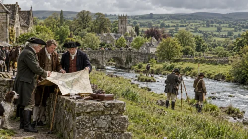
Early county boundaries were influenced by former kingdoms, settlements, rivers, estates, geography, military organisation and systems of justice.
Some counties developed around important settlements. Others evolved from older political territories.
Natural features often helped to form boundaries. Rivers, ridges, hills and coastlines provided practical divisions between neighbouring areas.
However, historic boundaries were not always simple. Some counties contained detached areas or irregular borders because of medieval land ownership, church property and long-standing territorial arrangements.
England’s shires gradually became established geographic divisions. Scotland developed sheriffdoms and later counties.
Wales gained a more structured county system through medieval and Tudor reforms, while the six traditional counties of Northern Ireland became established through later administrative changes.
This history explains why counties vary significantly in area and shape. They were not designed according to a fixed national formula.
What Makes an Area a County?
There is no modern UK-wide rule stating that an area becomes a county once it reaches a particular population, size or economic importance.
The answer depends on which form of county is being discussed.
Historic counties developed through centuries of political and geographic change. They are not determined by a modern population threshold.
Administrative areas, by contrast, can be created, merged or altered through legislation and local government reform.
Factors that may influence modern local authority boundaries include:
- Population Distribution
- Community Identity
- Public Service Delivery
- Financial Sustainability
- Economic Connections
- Transport Links
- Geographic Practicality
A city can also sit within a county without itself being a county. Sheffield is a clear example because its modern location within South Yorkshire sits alongside its much older Yorkshire identity, which is why understanding what county Sheffield is in requires looking at both historic and modern geography.
The same principle applies across Britain. Geographic identity and administrative responsibility can exist on different boundaries.
What Is the Difference Between Historic, Ceremonial and Administrative Counties?
The term county can describe several different geographic systems.
| County Type | Meaning | Main Use |
| Historic County | Long-established geographic and cultural area | Heritage, geography and identity |
| Ceremonial County | Area used for lieutenancy and ceremonial purposes | Ceremonial representation |
| Administrative County or Area | Territory organised for local government | Public services and administration |
| Unitary Authority | Single council responsible for most local services | Local government |
| Council Area | Main form of local government in Scotland | Local administration |
| Principal Area | Main local government division in Wales | Local administration |
Historic counties include areas such as Yorkshire, Middlesex, Cumberland and Westmorland.
Ceremonial counties are mainly relevant in England and are used for purposes including lord lieutenancies.
Administrative geography is different again and can change when councils are merged or reorganised.
This explains why a person’s historic county, ceremonial county and current council area may not always share the same name.
How Many British Counties Are There?
The number depends entirely on which county system is being counted.
When referring to the historic counties of the United Kingdom, there are 92.
| UK Nation | Number of Historic Counties |
| England | 39 |
| Scotland | 34 |
| Wales | 13 |
| Northern Ireland | 6 |
| Total | 92 |
This does not mean that the UK has 92 current administrative counties. Modern local government operates differently in England, Scotland, Wales and Northern Ireland.
Historic Counties of England
England has 39 historic counties:
Bedfordshire, Berkshire, Buckinghamshire, Cambridgeshire, Cheshire, Cornwall, Cumberland, Derbyshire, Devon, Dorset, Durham, Essex, Gloucestershire, Hampshire, Herefordshire, Hertfordshire, Huntingdonshire, Kent, Lancashire, Leicestershire, Lincolnshire, Middlesex, Norfolk, Northamptonshire, Northumberland, Nottinghamshire, Oxfordshire, Rutland, Shropshire, Somerset, Staffordshire, Suffolk, Surrey, Sussex, Warwickshire, Westmorland, Wiltshire, Worcestershire and Yorkshire.
These should not be confused with England’s current ceremonial counties or local government areas.
Historic Counties of Scotland
Scotland has 34 historic counties:
Aberdeenshire, Angus, Argyllshire, Ayrshire, Banffshire, Berwickshire, Buteshire, Caithness, Clackmannanshire, Cromartyshire, Dumfriesshire, Dunbartonshire, East Lothian, Fife, Inverness-shire, Kincardineshire, Kinross-shire, Kirkcudbrightshire, Lanarkshire, Midlothian, Morayshire, Nairnshire, Orkney, Peeblesshire, Perthshire, Renfrewshire, Ross-shire, Roxburghshire, Selkirkshire, Shetland, Stirlingshire, Sutherland, West Lothian and Wigtownshire.
These historic counties are no longer the primary units of Scottish local government.
Historic Counties of Wales
Wales has 13 historic counties:
Anglesey, Brecknockshire, Caernarfonshire, Carmarthenshire, Cardiganshire, Denbighshire, Flintshire, Glamorgan, Merionethshire, Monmouthshire, Montgomeryshire, Pembrokeshire and Radnorshire.
Modern Welsh administration operates through a different system of principal areas and preserved counties, so the distinction between traditional and current boundaries is particularly important when looking at the wider structure of counties in Wales.
Historic Counties of Northern Ireland
Northern Ireland has six historic counties:
Antrim, Armagh, Down, Fermanagh, Londonderry and Tyrone.
These counties remain widely recognised geographically and culturally, although they are no longer the primary units used for local government.
Which Major Laws Changed the British County System?
Modern confusion around counties developed largely because systems of local government changed while historic county identities continued.
Several laws played major roles.
Local Government Act 1888
The Local Government Act 1888 introduced elected county councils in England and Wales.
This was an important change because it formalised the idea of an administrative county.
From this point, county geography and county administration increasingly became separate concepts.
Some large towns became county boroughs and handled many responsibilities independently from surrounding county councils.
This meant that the traditional geographic county and the administrative unit carrying the county name were not always exactly the same.
Local Government Act 1972
The Local Government Act 1972 introduced one of the largest reorganisations of local government in England and Wales.
Most of its major structural provisions took effect on 1 April 1974.
The reform created new metropolitan and non-metropolitan counties and districts.
New administrative areas included:
- Greater Manchester
- Merseyside
- West Midlands
- Humberside
- Avon
- Cleveland
Cumbria was also created as an administrative county, combining territory associated with Cumberland, Westmorland and surrounding areas.
Importantly, the legislation changed administrative structures. It did not simply erase historic county identities.
That distinction remains important today because many people continue to identify with older counties long after council boundaries have changed.
Local Government Act 1992
The Local Government Act 1992 created mechanisms for further structural and boundary reviews.
This led to another period of reorganisation and a wider use of unitary authorities.
Administrative counties such as Avon, Cleveland and Humberside were later abolished.
Again, the disappearance of an administrative area did not automatically redefine historic geography.
Why Have Some British Counties Changed, Disappeared or Been Reorganised?
Most counties that appear to have “disappeared” did so from administrative maps rather than from historic geography.
Middlesex is a well-known example.
Large parts of its former administrative territory became part of Greater London in 1965. However, Middlesex continues to be recognised as a historic county and remains part of local identity in many communities.
Cumberland and Westmorland stopped functioning as separate administrative counties after the 1974 reforms, when much of their territory became part of Cumbria.
Cumberland later returned as the name of a unitary authority in 2023, although the authority’s boundaries are not identical to those of the historic county.
Avon, Cleveland and Humberside illustrate the reverse process. They were created as modern administrative counties and were later abolished.
These examples show why a historic county map and a modern council map can look very different.
Did Local Government Reforms Abolish Historic Counties?
Administrative reform does not automatically abolish historic counties.
The major local government reforms of the 20th century replaced or reorganised councils and administrative areas.
Historic counties, by contrast, continue to be used in geography, heritage, sport, cultural identity and community organisations.
This explains why names such as Yorkshire, Lancashire, Middlesex, Cumberland and Westmorland remain familiar even where modern councils use different names or boundaries.
A county council is therefore not required for a historic county identity to continue.
How Are County and Local Authority Boundaries Changed Today?
Changes to modern council boundaries normally require a formal legal and administrative process.
Depending on the proposal, this can involve central government, local authorities, Parliament and relevant boundary bodies.
Modern reorganisations usually consider factors including:
- Community Identity
- Effective Local Government
- Population Size
- Financial Viability
- Public Services
- Economic Links
- Transport Connections
These reforms are designed primarily to improve administration rather than redraw Britain’s historic county geography.
This distinction can be seen in Derbyshire, where administrative structures operate alongside much older county identities. The relationship is especially visible when looking at Chesterfield’s county position, as the town remains strongly connected to Derbyshire despite wider changes in local government.
Are British County and Council Boundaries Changing in 2026?
Yes, although the main changes concern local government structures in England rather than the 92 historic counties.
During 2025 and 2026, the government pursued a major local government reorganisation programme aimed at replacing some two-tier council structures with unitary authorities.
The position changed significantly on 7 September 2026, when the government announced a review of the programme.
Decisions relating to areas including Essex, Hampshire, the Isle of Wight, Norfolk and Suffolk were withdrawn or placed under review.
The existing Surrey reorganisation continued separately.
This means that several proposals discussed earlier in 2026 should no longer be treated as final.
Norfolk illustrates why this matters. Proposed administrative reform does not alter Norfolk’s historic county identity, and Norwich continues to be associated with Norfolk regardless of changing council arrangements. The distinction becomes clearer when examining Norwich’s county position in its historical and modern context.
The 2026 review reinforces an important point. Local authority structures can change much faster than historic county identities.
How Do Counties Work Differently Across England, Scotland, Wales and Northern Ireland?
The United Kingdom does not operate one single county system.
Each of its four constituent countries has developed its own structure.
England
England has the most complex arrangement.
It uses:
- County Councils
- District Councils
- Unitary Authorities
- Metropolitan Districts
- London Boroughs
- Ceremonial Counties
- Historic Counties
This overlapping geography can cause confusion in heavily urbanised areas.
London is one of the clearest examples. Greater London operates as a modern administrative and ceremonial area, while parts of the capital also lie within historic counties such as Middlesex, Essex, Kent, Surrey and Hertfordshire. This is why the question of what county London is in depends on whether the discussion concerns historic or modern geography.
Scotland
Scotland does not use its historic counties as its main form of local government.
Modern Scotland is divided into 32 council areas.
These became the main local government units following reforms introduced in 1996.
Historic names such as Perthshire, Ayrshire, Inverness-shire and Lanarkshire remain widely used culturally and geographically.
Wales
Wales operates through 22 principal local government areas, consisting of counties and county boroughs.
It also has preserved counties used for ceremonial purposes.
These exist alongside the 13 historic Welsh counties.
As a result, a Welsh location can sometimes be associated with a historic county, a preserved county and a modern principal area at the same time.
Northern Ireland
Northern Ireland’s six historic counties remain widely recognised, but modern local government operates through districts.
The counties of Antrim, Armagh, Down, Fermanagh, Londonderry and Tyrone therefore continue primarily as geographic, historic and cultural areas.
Why Can One Place Have More Than One County Name?
A town or city can have more than one county association because several geographic systems overlap.
A single place may have:
- A Historic County
- A Ceremonial County
- A Local Authority
- A Former Administrative County
- A Postal Association
These descriptions are not necessarily contradictory.
One name may describe historic geography while another identifies the council that currently provides local services.
Urban areas affected heavily by 20th-century reform are particularly likely to have several county associations.
Are Postal Counties the Same as Historic or Ceremonial Counties?
No. Postal counties should not be used as a definitive guide to historic or ceremonial geography.
Modern UK addresses rely primarily on post towns and postcodes.
Traditional postal counties stopped being required parts of Royal Mail addresses many years ago.
A familiar county name may still appear in addresses because residents and businesses continue to use it, but that does not necessarily identify the current local authority or ceremonial county.
Anyone trying to establish a county should first determine which geographic definition they actually need.
How Can You Find Out Which County You Live In?
The correct answer depends on the purpose of the search.
For heritage, genealogy or historic geography, the historic county is usually most relevant.
For ceremonial purposes, the relevant lieutenancy area should be checked.
For council tax, planning, rubbish collection, social care or other public services, the current local authority is what matters.
This is why one town can have more than one correct county-related description.
Nuneaton provides a useful example because its traditional Warwickshire association sits within modern local government arrangements. Understanding which county Nuneaton is in depends on separating those different geographic meanings.
Which Are the Largest and Smallest British Counties?
The answer depends on the county system being measured.
Under the historic county framework, Yorkshire is the largest historic county in Britain.
It traditionally covers roughly 6,000 square miles and is historically divided into the East Riding, North Riding and West Riding.
The smallest historic county in Britain is Clackmannanshire in Scotland.
Within England, Rutland is the smallest historic county.
These rankings can change when ceremonial or administrative areas are used instead, so the county framework should always be stated when comparing size.
How Have British Counties Shaped Regional Identity and Culture?
County identity remains strongly embedded in British life.
Accents, traditional food, architecture, industries, sporting rivalries, festivals and local customs are often closely associated with county boundaries.
Yorkshire retains one of the strongest regional identities in England.
Cornwall has a distinctive cultural and linguistic heritage.
Lancashire’s historic identity remains closely tied to manufacturing and textiles.
Devon and Somerset continue to reflect strong agricultural, rural and coastal traditions.
County identity is also expressed through county flags, sporting organisations and local celebrations.
Yorkshire Day on 1 August is one of the best-known examples of a county celebration.
These traditions demonstrate that counties are not simply old administrative labels. They continue to influence how communities describe themselves.
How Has the British County System Changed From Its Origins to 2026?
The modern county system is best understood as a series of historical layers.
The earliest layer developed from shires, kingdoms, sheriffdoms and medieval counties.
The 19th century introduced elected county councils and increasingly formal administrative counties.
The 20th century brought major restructuring.
Greater London was created in 1965.
The Local Government Act 1972 reshaped English and Welsh local government from 1974.
Scotland replaced older county government with regions and districts in 1975 and later introduced 32 council areas in 1996.
Wales also moved through successive systems before reaching its present structure of principal areas.
England continued to expand the use of unitary authorities during later reforms.
By 2026, another major period of English local government reorganisation was underway, although several proposals were placed under review in September.
Through all of these administrative changes, historic county identities have remained far more stable.
Conclusion
British counties represent more than a single system of administrative boundaries.
The historic framework contains 92 counties across the United Kingdom, including 39 in England, 34 in Scotland, 13 in Wales and six in Northern Ireland.
Modern government does not operate through these 92 counties as one unified system.
England, Scotland, Wales and Northern Ireland each organise local government differently.
Major laws including the Local Government Acts of 1888, 1972 and 1992 changed administrative geography substantially, but these reforms did not simply erase historic counties.
That distinction remains particularly important in 2026 as England continues to reconsider some local authority structures.
Council areas may continue to change, but historic county names remain deeply connected to British geography, heritage and regional identity.
Frequently Asked Questions
When Were British Counties First Created?
There was no single creation date. English shires began developing during the Anglo-Saxon period, while Scottish, Welsh and Irish county systems developed through separate historical processes.
Who Decides Whether an Area Becomes a County?
Modern administrative areas can be created or changed through legislation and government reorganisation. Historic counties developed gradually over centuries rather than through today’s boundary review system.
Can the Government Create or Remove a County?
The government and Parliament can create, alter or abolish administrative areas. This does not necessarily create or remove a historic county.
How Many Historic Counties Are There in Britain?
There are 92 historic counties across the United Kingdom, with 39 in England, 34 in Scotland, 13 in Wales and six in Northern Ireland.
Why Are Historic and Modern County Boundaries Different?
Modern boundaries have been reorganised repeatedly to improve council administration and public services. Historic county boundaries developed much earlier and generally remain associated with geography and identity.
Is a Shire the Same as a County?
The terms became closely connected historically. Many English counties originated as Anglo-Saxon shires, which is why names such as Yorkshire, Hampshire and Wiltshire retain the “-shire” ending.
Why Do Some Counties No Longer Have County Councils?
A county council is an administrative institution rather than a requirement for a historic county to exist. Local government reform has replaced many county councils with unitary authorities and other structures while older county identities have continued.